Tharsis rises and tips the planet over
Three hundred million cubic kilometres of magma built a bulge across a quarter of Mars, raised Olympus Mons some 22 km, and probably tipped the spin axis about 20 degrees.
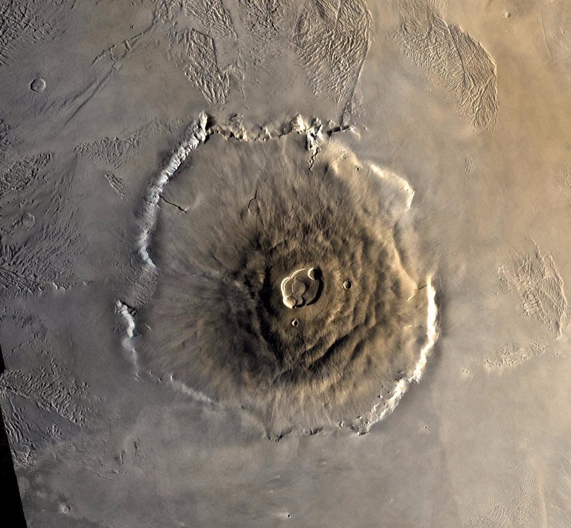
Tharsis is a welt roughly 5,000 km across, standing as much as 7 km proud of the datum and covering about a quarter of the martian surface. Three giant shields — Arsia, Pavonis and Ascraeus Mons — sit along its crest, each 350 to 400 km wide and some 17 km above the plain. Olympus Mons, off the northwestern flank, is larger again: a base more than 600 km across, which NASA likens to the area of Arizona, ringed by a scarp up to 6 km high. Its summit stands about 22 km above the Mars datum and roughly 25 km above the plain at its foot; quoted heights reach 27 km, NASA's own pages included, because the ground beneath it is not level.
The reason it got that big is that nothing moved. On Earth a plate slides over a fixed hotspot and the magma builds a chain of separate islands; Hawaii is a conveyor belt. Mars has no plate tectonics, so a hotspot pours into one spot for billions of years and the pile keeps growing. It may not have finished: Mars Express stereo imaging dated caldera resurfacing on five big martian volcanoes to the last fifth of the planet's history, with phases as young as two million years.
Roger Phillips and colleagues weighed it in 2001, using Mars Global Surveyor's gravity field and MOLA topography: about 3 × 10⁸ cubic kilometres of magma. A load that large does not just sit there. It rings Tharsis with negative gravity anomalies and a topographic trough, and raises an answering high on Arabia Terra. Phillips showed that valley networks near Tharsis drain along slopes that load created — so the trough and its antipodal high, he argued, were largely in place by the end of the Noachian.
What the magma released is the climate half of the story. Phillips's team put it at the equivalent of a 1.5-bar carbon dioxide atmosphere and a global water layer about 120 metres deep — enough, they argued, to hold a warmer climate than the present one and cut the valleys. Tharsis handed Mars that atmosphere several hundred million years after the magnetic field that might have shielded it was gone. Volcanoes also emit sulfur, and sulfate aerosols cool rather than warm, so whether an eruption left Mars warmer or colder is not a settled calculation.
The load was heavy enough to move the planet. A mass that large away from the equator is rotationally unstable, and Mars reoriented to bring it onto the equator — true polar wander. Sylvain Bouley's group reconstructed the pre-Tharsis rotational figure in 2016; the swing usually taken from that work is about 20 degrees, which would mean the valley networks were carved on a Mars whose poles sat elsewhere. Its size and its date are both poorly constrained. The reconstruction also makes Tharsis contemporaneous with the valleys rather than earlier, against Phillips — and that order decides whether Tharsis caused the rivers or merely showed up alongside them.