Mars Global Surveyor maps the planet Mars Observer lost
Mars Observer died three days short of orbit in 1993. Its instruments were rebuilt as Global Surveyor, which found fossil crustal magnetism and geologically fresh gullies.
Mars Observer was NASA's first mission to Mars in seventeen years: $813 million, eight instruments, a spacecraft built on a commercial Earth-satellite bus. On 21 August 1993, eleven months into the cruise and three days before orbit insertion, controllers commanded it to pressurise its propulsion system for the braking burn. Nothing came back, then or ever. A Naval Research Laboratory board concluded the most probable cause was that nitrogen tetroxide had seeped past check valves into the pressurisation plumbing during the long coast, met monomethylhydrazine when the helium valve opened, and ruptured a line — leaving the spacecraft spinning too fast to point its antenna. No data, no images, nothing.
NASA's answer was to build the instruments a second time. Mars Global Surveyor flew flight spares and rebuilt Mars Observer designs — the Mars Orbiter Camera, the Mars Orbiter Laser Altimeter, the Thermal Emission Spectrometer, the magnetometer and electron reflectometer — on a far smaller spacecraft: $154 million to design and build, $65 million more to launch. It went up on 7 November 1996 and reached Mars on 12 September 1997.
It then nearly failed too. One solar panel had not latched on deployment, and aerobraking — dipping through the upper atmosphere hundreds of times to shed orbital energy instead of carrying the fuel to do it — loaded exactly the wrong hinge. Controllers halved the drag and stretched a four-month manoeuvre into roughly eighteen. Systematic mapping did not begin until March 1999.
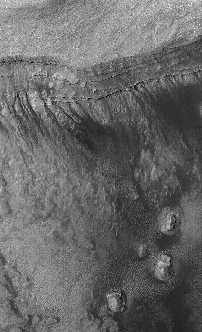
What came out of it reset the planet. The magnetometer found intensely magnetised stripes hundreds of kilometres long in the ancient southern highlands, among the strongest crustal magnetism known anywhere in the solar system — the fossil of a core dynamo that had already shut down when the Hellas and Argyre basins were excavated, and with it the magnetic shield that would have slowed atmospheric loss. MOLA measured global topography to about a metre vertically and showed the northern plains to be flatter than any comparable surface on Earth. In June 2000 Michael Malin and Kenneth Edgett published images of gullies cut into steep crater walls, with alcoves, channels and debris aprons and almost no craters on top of them: geologically young, possibly active. Whether they require liquid water or can be carved by dry carbon-dioxide flows is still argued today.
Global Surveyor mapped for more than seven years, and doubled as a radio relay for the rovers working below it. It last spoke on 2 November 2006. A routine command to move a solar array tripped a parameter that had been written to the wrong memory address five months earlier; the spacecraft turned itself into an attitude that left one battery in direct sunlight, and both batteries drained.